
Our Expertise
Our Dual-Use Application
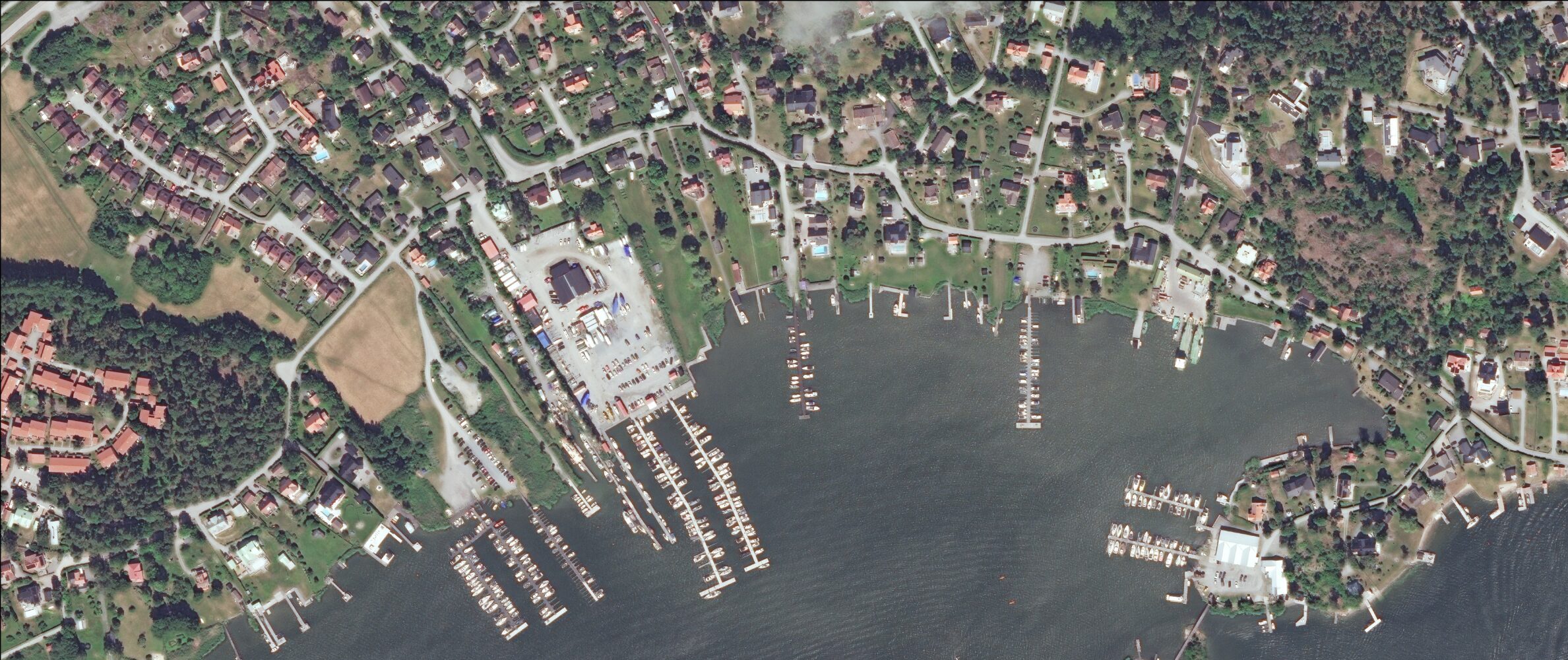
AquaGuard Technologies delivers a next-generation geospatial SaaS platform designed for dual-use application across both civil and security domains. Leveraging proprietary computer vision and deep-learning algorithms applied to high-resolution satellite imagery, we detect, track, and monitor abandoned and derelict vessels (ADVs) and surface anomalies across maritime and inland zones.
This dual-purpose built capability enables precise, real-time intelligence for environmental remediation, maritime safety, and homeland security operations — providing actionable insights via advanced 2D/3D geospatial mapping for fast, secure, and compliant response
The Problem
- Undetected abandoned vessels disrupt maritime safety and create legal blind spots
- No unified system for vessel lifecycle tracking across jurisdictions
- Abandoned and derelict (ADV) waste pollutes fragile coastlines and inland waters
- Illegal dumping and mismanaged waste hinder ESG and circular economy efforts
- Unmonitored zones allow non-AIS vessels and illicit activity to go unnoticed
- Border and coastal agencies lack real-time intelligence to respond to threats
Our Solution
- Real-time satellite-based detection and geolocation of ADVs, with visual proof and regulatory-grade metadata.
- AI-powered platform for vessel identification, lifecycle classification, and database linkage to maritime and insurance systems.
- End-to-end identification and classification of ADVs using satellite imagery and ground-truth data, enabling informed removal and recycling.
- Automated detection of illegal dumping, material degradation scoring, and exportable reports for ESG compliance and recovery value.
- Persistent object tracking with anomaly detection, flagging unregistered surface activity and supporting Maritime Domain Awareness (MDA).
- Custom alerting, geofencing, and secure data feeds for situational awareness across national security, defence, and SAR stakeholders.
Key Features
Detection & Classification
- Proprietary AI-powered geospatial software with verified pre-MVP detection performance
- Automated detection and classification of abandoned and derelict vessels (ADVs)
- High-precision geolocation with integrated mapping and tracking interface
- Compatible with high-resolution satellite and drone imagery inputs
Regulatory & Compliance
- Embedded legal and regulatory metadata for compliance-ready outputs
- ESG-aligned environmental risk scoring and regulation-ready reporting tools
- Exportable reports and structured data files for operational, regulatory, or policy use
- Designed for international deployment with multi-language and regulatory adaptability
Deployment & Collaboration
- Scalable SaaS architecture for government and commercial deployment
- Real-time alerts and anomaly notifications via secure, multi-device access
- Role-based access and secure collaboration tools for multi-agency coordination
- Configurable solution modules tailored to maritime, environmental and Defence markets
Built For Impact
Whether identifying wrecks in line with EU circular economy goals, detecting illegal dumping or unmonitored activity, or supporting border and maritime domain awareness, AquaGuard bridges the gap between visibility and action. Our platform empowers institutions to act quickly, confidently, and responsibly — with automated detection, AI-driven validation, and policy-ready outputs built for the real world.
Supported By
Funded by ESA and validated by leading EU agencies and circular economy leaders.”

Our Mission
Geospatial intelligence that advances security, compliance, and sustainability.
From orbital insight to ground-level action, AquaGuard Technologies delivers advanced geospatial intelligence that strengthens security, enforces environmental compliance, and supports global sustainability
We equip government, environmental, and defence stakeholders with ready-to-use satellite intelligence—enabling early intervention before surface-level risks escalate. Our proprietary platform integrates high-resolution optical and SAR imagery, ground-based edge-AI, and custom-trained analytics software into a unified, multimodal system. The result: regulatory-grade, mission-ready intelligence that powers smarter decisions where protection and planetary health align.
Request a Demo
Ready to see how AquaGuard Technologies can support your agency or operation?
Whether you’re tackling maritime abandonment, circular asset recovery, or strategic border surveillance — we’re here to help you act with precision, intelligence, and speed.